
Peoria ZIP Directory Coverage
Peoria County GIS supplies the strongest local geographic evidence for ZIP coverage. Its Administrative MapServer records postal name, ZIP number, and polygon area. The table separates Peoria-named polygons from codes that appear in postal references but did not appear as county polygons during research. Neighborhood names are not assigned by USPS, so they are not substituted for the official local evidence.
| ZIP | Areas Covered | Post Office | Local Evidence and Caution |
|---|---|---|---|
| 61601 | Peoria USPS code | Peoria | No county polygon returned; verify box or processing use by address. |
| 61602 | Peoria postal polygon, 1.13 sq. mi. | Peoria | Small city polygon, not a neighborhood list. |
| 61603 | Peoria postal polygon, 5.08 sq. mi. | Peoria | Check the parcel and city line in GIS. |
| 61604 | Peoria postal polygon, 16.58 sq. mi. | Peoria | Can span several community labels. |
| 61605 | Peoria postal polygon, 4.35 sq. mi. | Peoria | Use USPS to validate delivery. |
| 61606 | Peoria postal polygon, 1.24 sq. mi. | Peoria | Do not infer one institution from its small size. |
| 61607 | Peoria postal polygon, 32.05 sq. mi. | Peoria | Postal name does not place every parcel in the city. |
| 61614 | Peoria postal polygon, 12.63 sq. mi. | Peoria | Compare against municipal boundaries. |
| 61615 | Peoria postal polygon, 29.15 sq. mi. | Peoria | Large area, not one neighborhood. |
| 61625 | Peoria postal polygon, 0.03 sq. mi. | Peoria | Very small; verify limited or unique use. |
| 61635 | Peoria postal polygon, 0.93 sq. mi. | Peoria | County GIS postal-name polygon. |
Postal references also group 61650 through 61656 with Peoria and 61601, but no separate county area crosswalk was captured. Treat those as box or processing routes until USPS confirms a specific address. This ZIP code directory reports only verified scope and does not guess at neighborhood coverage.
Map Peoria ZIP Code Polygons
The county's ZIP polygon layer is the right tool for comparing area. The Peoria-named polygons range from 0.03 square miles for 61625 to 32.05 for 61607. That spread is a useful warning: a ZIP can cover a tiny limited-use area or a broad mix of parcels, yet neither size says who lives there.
The county GIS ZIP layer was captured for this Peoria ZIP code directory.
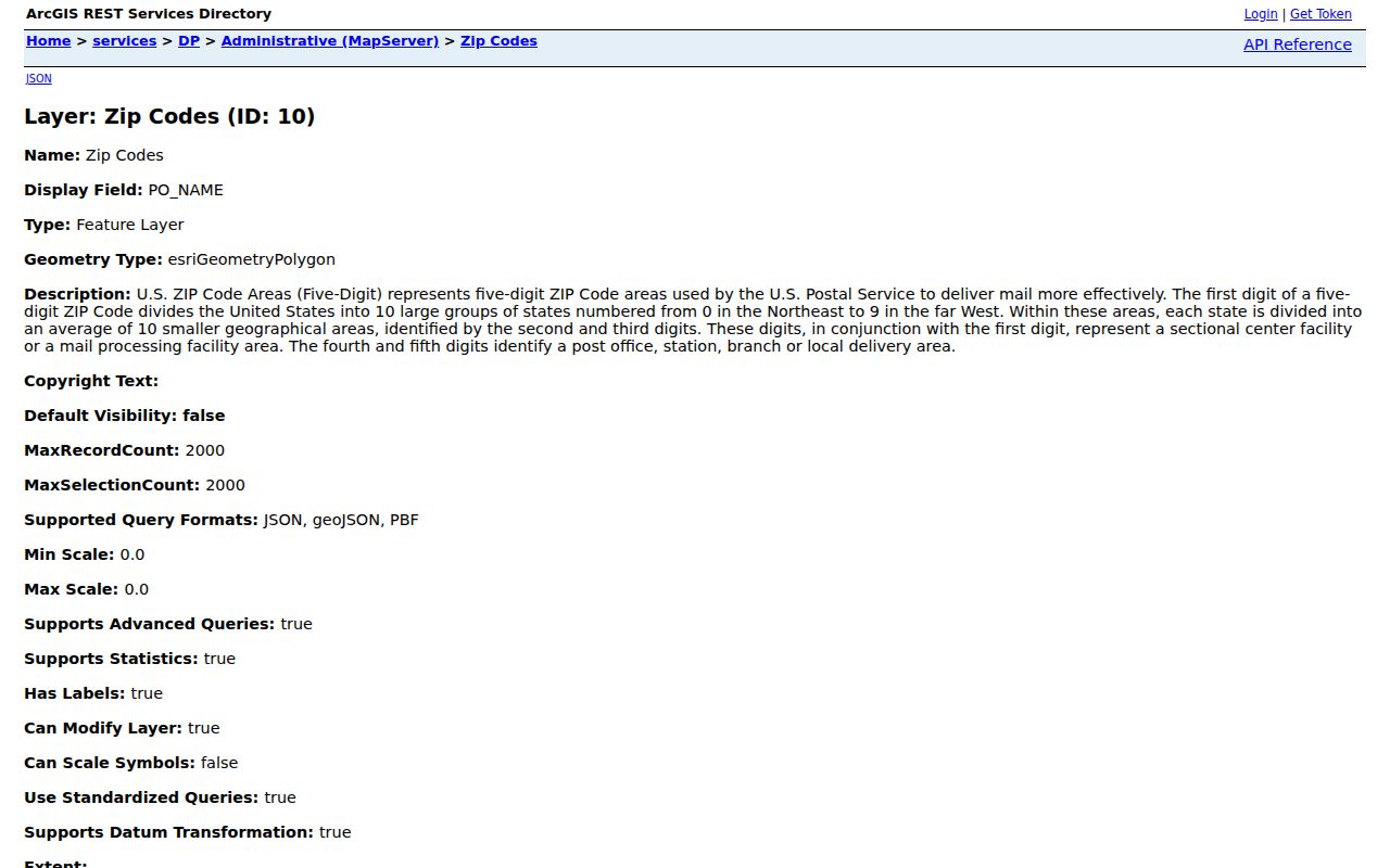
The map service supplies postal boundaries and area fields that can be overlaid with city, parcel, subdivision, and land-use layers.
A polygon is still not a resident list. Use it to identify the correct county area, then move to a portal that searches a person, parcel, credential, or claim. Keep the map's date and layer name with any saved result.
Find Peoria Residents by ZIP
Only some official systems accept ZIP. USPS verifies delivery geography. The Illinois voter lookup uses ZIP as part of a full identity match. State license and unclaimed-property searches accept ZIP as a filter. County GIS exposes a ZIP polygon and parcel postal ZIP field. The county Property Tax Inquiry has no ZIP box, so a ZIP-wide owner list cannot be pulled from its public form.
- Confirm the known mailing address through the USPS ZIP tool. Save the full standardized address and ZIP+4 when returned.
- Open county GIS and select the ZIP layer. Compare the polygon with municipal and parcel boundaries before calling the area Peoria city.
- Use ZIP in a state search only with the other facts that portal requires. A license, claim, or voter result answers a narrow agency question.
- Once a parcel or street is known, switch to an address-keyed source. The Peoria street directory explains that finer search.
This process prevents a broad postal clue from being presented as an exact home. It also keeps a nearby municipality from being folded into the wrong resident search.
Peoria ZIP Search Fields
Each portal treats ZIP differently. Entering the code in the wrong place can create a false match or no result. The field inventory below comes from the official interfaces reviewed for Peoria.
| Official Search | ZIP-Capable Fields | What the Result Means |
|---|---|---|
| USPS ZIP Lookup | Address; City and State; or ZIP | Validates postal city and code, not a person at the address. |
| Illinois voter status | Five-digit ZIP, then street number and street selector, plus name and birth date | Returns registration status, polling place, and districts for the supplied identity. |
| IDFPR License Lookup | City, state, county, and ZIP with name or license fields | Returns a credential record; city is not a home address. |
| Illinois Treasurer ICash | City and ZIP with owner, business, or property fields | Locates a claim record, not current occupancy. |
| Peoria County GIS | ZIP polygon and parcel PZIP attribute | Shows mapped postal geography tied to parcel data. |
| Property Tax Inquiry | No ZIP field on the public form | Search by parcel, owner, house number, street, city, or advanced criteria. |
Note: The public Illinois voter lookup is not a reverse ZIP roster, and authorized voter-file release has strict statutory conditions.
Verify Peoria ZIP Codes First
The USPS ZIP Lookup offers three routes. The address mode uses street, city, state, and optional company or unit information. City and state can return applicable codes. A ZIP can return its postal cities. USPS expressly warns that the result does not confirm that a person or company is located at an address.
- ZIP
- A postal routing code. It is not a legal city or neighborhood boundary.
- ZIP+4
- The basic code plus four digits that narrow delivery to a smaller segment.
- PO-box ZIP
- A code used mainly or wholly for post-office boxes rather than a mapped residential area.
- Unique ZIP
- A code assigned for a single high-volume recipient or limited use.
- Carrier route
- A delivery path within a ZIP, not a public list of households.
Use the postal result as one part of the Peoria ZIP code directory workflow. County GIS then answers the geographic question, while the agency holding a resident record answers the person question.
Who Assigns Peoria ZIP Addresses
Four authorities can describe one address. City Public Works assigns new addresses inside Peoria through the municipal grid. County addressing handles new or corrected 9-1-1 locations outside Peoria and Chillicothe city limits. USPS controls delivery formatting and ZIP. County tax and GIS systems tie the parcel to a PIN, legal description, and mapped geometry.
The Peoria County Address Request explains that a 9-1-1 address change does not change a postal mailing address.
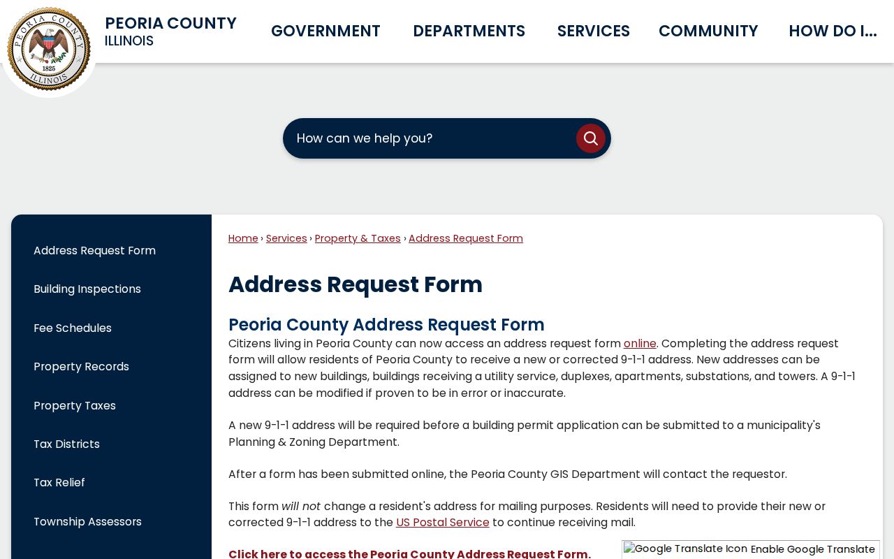
The captured form helps separate emergency-location authority from USPS delivery geography.
This distinction is crucial when a mailing name remains Peoria but the parcel lies in an unincorporated area or another municipality. Keep the mailing address, situs address, legal description, and owner mailing address as separate fields.
Nearby ZIPs Beyond Peoria
Codes near the city can look local without being City of Peoria polygons. County research identifies 61610 with Creve Coeur, 61611 with East Peoria, and 61616 with Peoria Heights. Postal references group 61612 through 61616 under a Peoria sorting label, but that label does not erase municipal boundaries.
Do not add an address to a Peoria resident set from the code alone. Verify the actual delivery address with USPS, then inspect county municipal and parcel layers. This is especially important for family history, service contacts, and parcel research in areas where residents casually use “Peoria” for the wider region.
Peoria ZIP Geography at Scale
Census QuickFacts estimated 110,920 people in Peoria city and 178,553 in Peoria County for 2025. The city's reported land area is 47.97 square miles, while the county covers 618.73 square miles. Those figures do not count residents by ZIP, but they show why a postal code and county search can reach well beyond city limits.
No official current Peoria registration total by ZIP or precinct was located. Do not estimate one from individual voter lookups or parcel counts. Request a published statistic from the proper election office and retain its date, geography, and method.
Peoria ZIP and City Limits
ZIP boundaries serve mail delivery. Peoria city limits determine municipal jurisdiction. Parcel boundaries establish legal land geometry, and 9-1-1 addresses support emergency response. A tax owner's mailing address can even sit outside all four local areas. A Peoria ZIP code directory must keep these systems separate.
Boundary check. A Peoria postal code, tax owner, court party, or license city does not by itself prove that someone lives at a parcel.
For a precise result, record the standardized USPS address, county PIN, legal description, municipal polygon, and source date. That set can support a sound lookup without turning postal geography into an unsupported claim about a person or neighborhood.
Changes in a mailing route do not always change the county parcel, and a new emergency address does not by itself alter the postal address. Recheck all four systems when an old directory, deed, or family paper uses a form that current tools reject. City Public Works, county addressing staff, USPS, and the parcel custodian each control a different part of the answer.
When the exact code remains unclear, begin with the fallback channels. Use the USPS address form, inspect the county GIS map, and contact the city or county address office based on the municipal boundary. A narrow request should include the street, house number, subdivision or lot when known, and the question being asked. Do not ask an office for a ZIP-wide list of people.